
Destination
Engaruka Ruins
At the foot of the Rift Valley escarpment, near Lake Natron, lie the ruins of a farming settlement dating from the 15th to 18th centuries. Its stone terraces and irrigation channels show early African engineering, and why the community abandoned it remains a mystery.
Destination Overview
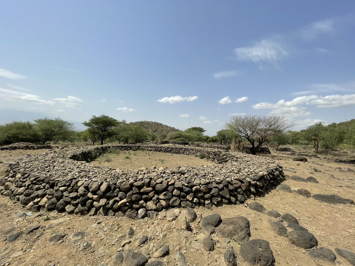
The Engaruka Ruins sit at the base of the Great Rift Valley escarpment in northern Tanzania’s Arusha Region, about 60 kilometres north of Mto wa Mbu on the road to Lake Natron. Between roughly the 15th and 18th centuries, a thriving farming community lived here, spread across several villages built on the slopes of the escarpment. Its people created an impressive landscape of stone-walled terraces, circular house platforms, and cairns, much of which can still be traced today. What sets Engaruka apart is its sophisticated irrigation system: water from the Engaruka River and mountain springs was diverted through a network of stone-lined channels and canals into neatly divided fields on the valley floor, allowing the community to grow crops in an otherwise dry environment. At its peak, the settlement covered around 20 square kilometres and may have supported several thousand people.
By the 18th century, Engaruka had been abandoned, and the reasons remain uncertain. Archaeologists suggest that shifts in water supply, changes in the river’s course, soil exhaustion, or conflict may have played a part, while the identity of the original builders is still debated. The site attracted scientific interest in the early 20th century, notably through excavations by Louis Leakey in the 1930s, and it is now protected as a national monument. Today, visitors can walk among the crumbling walls and terraces with a local guide, follow the old water channels, and enjoy sweeping views of the Rift Valley, making Engaruka a fascinating stop for anyone interested in East Africa’s history and early engineering.

Ancient Engaruka Ruins
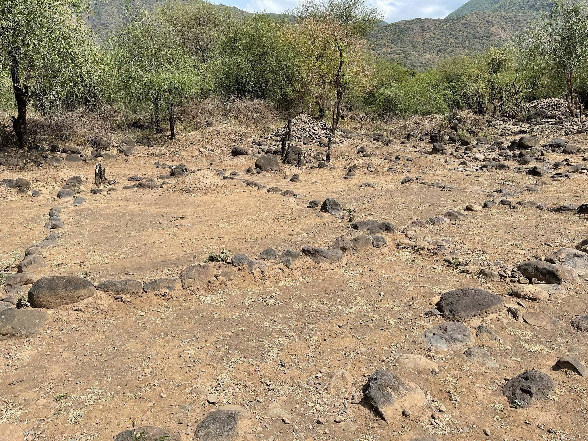
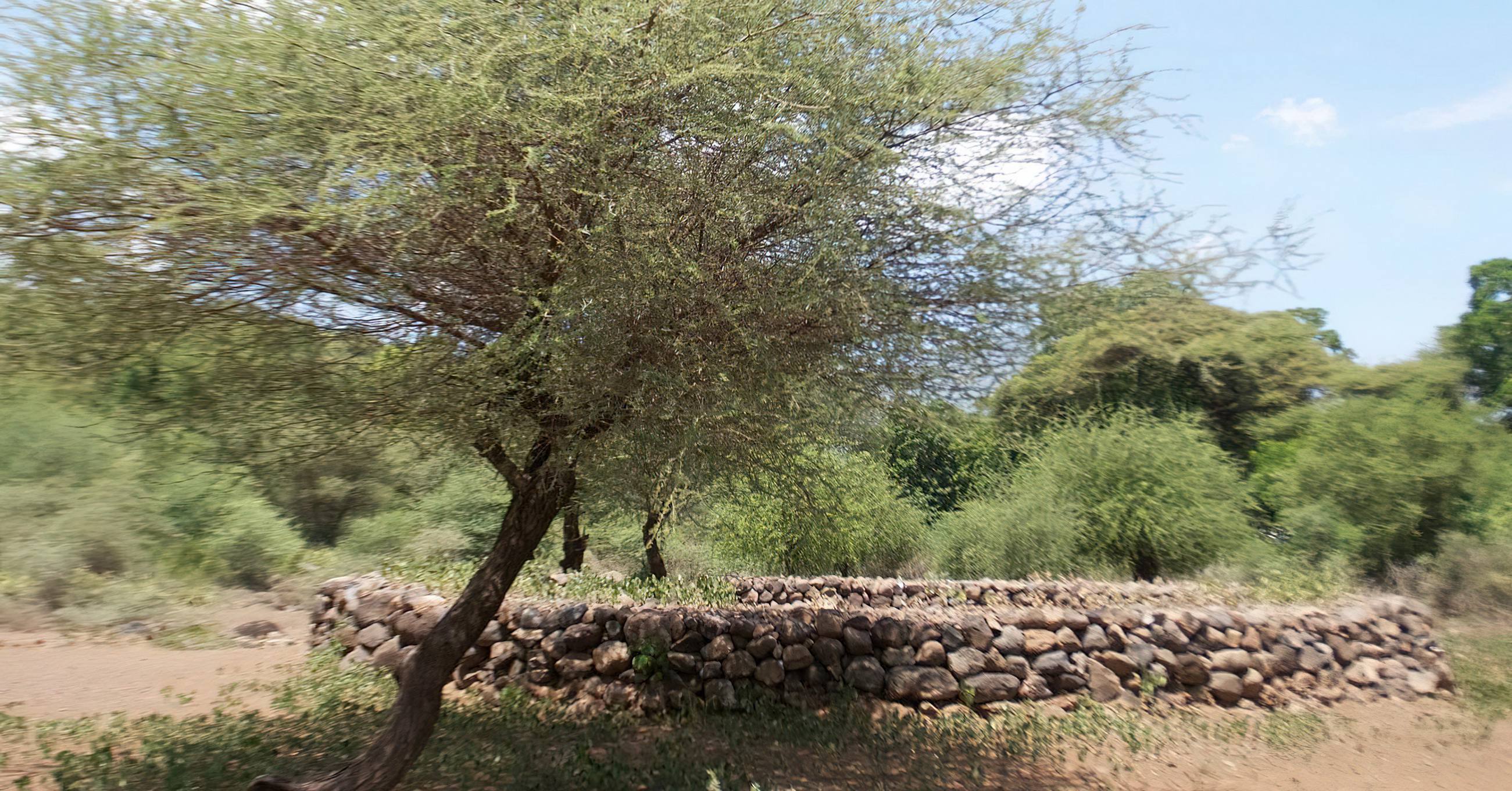
The heart of any visit is the ruins of a farming settlement that flourished between the 15th and 18th centuries. Scattered across the base of the escarpment are stone-walled terraces, circular house platforms, and cairns that once formed several villages, home to thousands of people. Walking through them with a local guide reveals how the community lived, farmed, and organised its land, making it one of the most significant archaeological sites in East Africa.
Remarkable Irrigation System
Engaruka is famous for its early engineering. The original inhabitants diverted water from the Engaruka River and mountain springs through stone-lined channels and canals, feeding a network of carefully divided fields on the dry valley floor. Visitors can trace the remains of these channels and see how some of the same water sources still support farming in the area today.
A Mystery Still Unsolved
Part of Engaruka’s appeal is its unanswered questions. Why the settlement was abandoned in the 18th century, and exactly who built it, are still debated by archaeologists. Theories range from changes in water supply and soil exhaustion to conflict, giving the site an intriguing sense of mystery for curious travellers.
Great Rift Valley Scenery
Engaruka sits at the foot of the dramatic Rift Valley escarpment, with wide plains stretching out below. The contrast of steep cliffs, open savanna, and green irrigated strips creates striking landscapes, especially in the soft light of early morning and late afternoon.
Escarpment Hiking and Panoramic Views
Guided hikes up the escarpment lead to sweeping views over the valley floor, the ruins, and on clear days toward Ol Doinyo Lengai, the Maasai’s “Mountain of God” and an active volcano. The walks suit a range of fitness levels and offer a rewarding way to experience the area on foot.
Maasai Culture and Local Communities
The surrounding area is home to Maasai communities who continue to herd livestock across the plains, alongside farming villages that still use irrigation. Cultural visits give travellers the chance to learn about traditional homesteads, daily life, livestock keeping, and local customs, while supporting the community directly.
Wildlife on the Plains
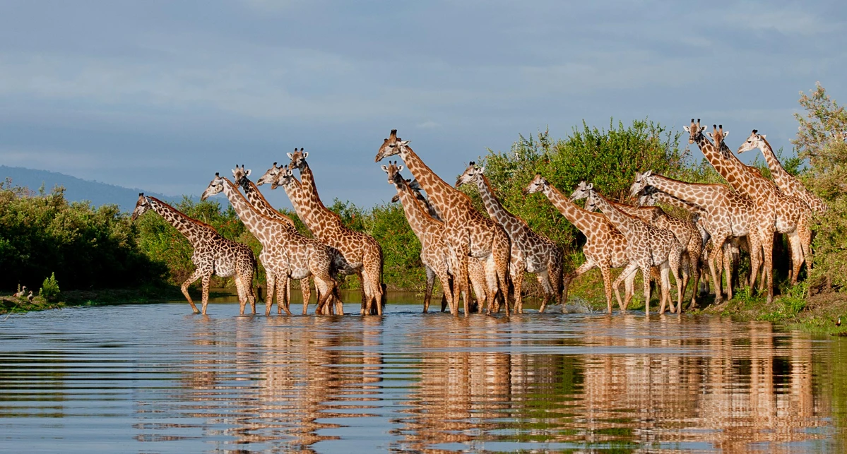
Although Engaruka is not a national park, the open country around it supports wildlife such as Maasai giraffe, zebra, Grant’s and Thomson’s gazelles, gerenuk, lesser kudu, oryx, dik-dik, and olive baboons. Sightings add an element of safari to a cultural and historical visit.
Rewarding Birdwatching
The dry bushland and plains are excellent for birding, with species such as the ostrich, kori bustard, secretarybird, lilac-breasted roller, superb starling, Von der Decken’s hornbill, and the Tanzanian rufous-tailed weaver. Lesser flamingos can sometimes be seen flying overhead on their way to Lake Natron.
Gateway to Lake Natron and Ol Doinyo Lengai
Engaruka lies on the route between Mto wa Mbu and Lake Natron, making it an ideal stopover on the way north. It pairs perfectly with visits to Lake Natron’s flamingo flocks, the Ngare Sero waterfalls, and treks up Ol Doinyo Lengai, adding history and culture to a wilder, off-the-beaten-path itinerary.
Off the Beaten Path Experience
Far from the busy safari circuits, Engaruka offers a quiet, authentic experience with few crowds. Travellers can explore at their own pace, connect with local guides, and enjoy a side of northern Tanzania that many visitors miss.
Camping Under Open Skies
Simple campsites in the area allow visitors to stay overnight and enjoy clear, star-filled skies, the stillness of the Rift Valley, and an early start for hiking and exploring the ruins before the heat of the day.
Activities in Engaruka Ruins
- Guided tour of the ancient ruins and stone terraces
- Walking along the old irrigation channels
- Hiking up the Rift Valley escarpment for panoramic views
- Cultural visits to nearby Maasai villages
- Birdwatching in the surrounding plains and woodland
- Photography, with views toward Ol Doinyo Lengai
- Camping under the open sky
- A scenic stopover on the way to Lake Natron
Year-Round Weather in Engaruka Ruins
Rainfall is low compared to the nearby highlands and comes in two seasons. The short rains fall from about November to December, and the long rains from March to May, bringing heavier showers that turn the plains green but can make roads muddy. The rest of the year is mostly dry, with clear skies, dusty conditions, and occasional strong winds, making June to October the most reliable period for visiting.
Want to see more? This video is worth watching
Related Trips
Discover Tanzania
Your questions answered
Where is Engaruka located?
Engaruka lies in northern Tanzania’s Arusha Region, at the foot of the Great Rift Valley escarpment. It sits about 60 kilometres north of Mto wa Mbu, along the road to Lake Natron, between the Ngorongoro Highlands to the west and the open Maasai plains to the east. Its location makes it a natural stop for travellers heading north towards Lake Natron and Ol Doinyo Lengai.
How do I get to Engaruka?
Most visitors travel by road from Arusha, which takes around 3.5 to 4 hours. The first part of the journey to Mto wa Mbu is on tarmac, followed by a rougher gravel road to Engaruka. At iTour Tanzania, we arrange all transfers in a comfortable 4x4 safari vehicle with an experienced driver-guide, so you can relax and enjoy the Rift Valley scenery along the way.
What makes Engaruka worth visiting?
Engaruka is home to one of East Africa’s most important archaeological sites: the ruins of a farming settlement that thrived between the 15th and 18th centuries. Its stone terraces, house platforms, and advanced irrigation channels show remarkable early African engineering. Add the dramatic escarpment scenery, Maasai culture, wildlife on the plains, and the fact that few tourists visit, and Engaruka offers a rich and authentic experience that most safari itineraries miss.
Who built the Engaruka settlement, and why was it abandoned?
These remain some of the site’s great mysteries. Archaeologists agree that a large farming community lived here for several centuries, but the exact identity of the builders is still debated. The settlement was abandoned around the 18th century, possibly due to changes in water supply, a shift in the river’s course, soil exhaustion, or conflict. Our local guides share the leading theories along with the stories passed down in the surrounding communities.
Do I need a guide to visit the ruins?
Yes, a guide is strongly recommended and usually required. The ruins are spread over a wide area and are not always easy to interpret on your own. A knowledgeable local guide will lead you to the most significant terraces, house circles, and water channels, explain their history, and help you understand how the community lived. We arrange certified local guides as part of every Engaruka visit, which also directly supports the local community.
How much time should I spend at Engaruka?
A half-day visit is enough to tour the main parts of the ruins. However, we recommend at least one full day, or an overnight stay, if you also want to hike the escarpment, visit a Maasai village, or enjoy birdwatching. Engaruka works especially well as part of a 2 to 3 day trip combined with Lake Natron, or as an add-on to a wider northern Tanzania safari.
What activities can I do at Engaruka?
Visitors can take a guided tour of the ruins, walk along the ancient irrigation channels, hike the Rift Valley escarpment for panoramic views, visit Maasai homesteads, go birdwatching, spot wildlife on the surrounding plains, and enjoy photography with views toward Ol Doinyo Lengai. Camping under the clear night sky is another memorable experience.
What wildlife can I see around Engaruka?
Engaruka is not a national park, so wildlife sightings are less predictable than in places like the Serengeti. Still, the plains around it support Maasai giraffe, zebra, wildebeest, Grant’s and Thomson’s gazelles, gerenuk, lesser kudu, oryx, dik-dik, olive baboons, and jackals. Birdlife is excellent, with species such as ostrich, kori bustard, secretarybird, lilac-breasted roller, and the rufous-tailed weaver, a bird found only in this part of East Africa.
When is the best time to visit?
The dry season from June to October is the best time to visit. Roads are easier to drive, the ruins are clearer of tall grass, and the weather is ideal for walking and hiking. December to February is also a good option. The long rains from March to May can make roads muddy and difficult, so we generally advise against visiting during this period. Since Engaruka is hot year-round, we schedule ruin tours for the early morning.
What is the weather like?
Engaruka has a hot, semi-arid climate. Daytime temperatures usually reach around 28–35°C, with October to February being the hottest months and June to August slightly cooler. Rainfall is low, falling mainly during the short rains in November and December and the long rains from March to May.
Where can I stay in or near Engaruka?
Accommodation in Engaruka itself is simple, mainly campsites and basic local guesthouses. For travellers who prefer more comfort, we can arrange stays at lodges and tented camps around Lake Natron or Mto wa Mbu, with a day visit to Engaruka. As with all iTour trips, we offer budget, mid-range, and luxury options so you can choose what suits you best.
Is Engaruka suitable for families and children?
Yes. Engaruka is a great destination for families, especially those with children interested in history, nature, and culture. The ruin walks are mostly gentle, though the terrain can be rocky and hot, so we recommend sturdy shoes, sun protection, and plenty of water. Escarpment hikes can be adjusted to suit younger or less experienced walkers.
Is Engaruka safe to visit?
Yes, Engaruka is considered safe for visitors. The local communities are welcoming, and travelling with an experienced iTour driver-guide and a local guide ensures a smooth and secure visit. As with anywhere, we advise following your guide’s advice, respecting local customs, and asking permission before photographing people.
What should I pack for a visit to Engaruka?
We recommend light, breathable clothing, a wide-brimmed hat, sunglasses, and high-SPF sunscreen. Comfortable walking shoes or hiking boots are essential for the rocky ground. Bring a refillable water bottle, insect repellent, a light jacket for cooler mornings and evenings, binoculars for birdwatching, and a camera for the scenery.
Are there entry fees?
Yes, visitors pay a site entrance fee and a local guide fee, which go towards preserving the ruins and supporting the community. When you book with iTour Tanzania, all fees are included in your trip, so there are no surprises on the day.
Can I combine Engaruka with other destinations?
Absolutely. Engaruka pairs perfectly with Lake Natron, where you can see large flocks of flamingos and visit the Ngare Sero waterfalls, and with a sunrise climb of Ol Doinyo Lengai, an active volcano. It also fits easily into longer itineraries that include Lake Manyara, Ngorongoro Crater, and the Serengeti.
Why book your Engaruka trip with iTour Tanzania?
As a Tanzanian-owned company based in Arusha, our team brings up to 15 years of experience in creating authentic journeys across the country, including lesser-known gems like Engaruka. We design private and small-group trips, work closely with trusted local guides and communities, and handle every detail from transport to accommodation and fees. Contact us today to request a quote and discover Tanzania, authentically.